Last Updated on October 24, 2023 by Neil Sharma
How does CoStar track cities’ commercial real estate developments in real time? By using a Cessna Aircraft, of course.
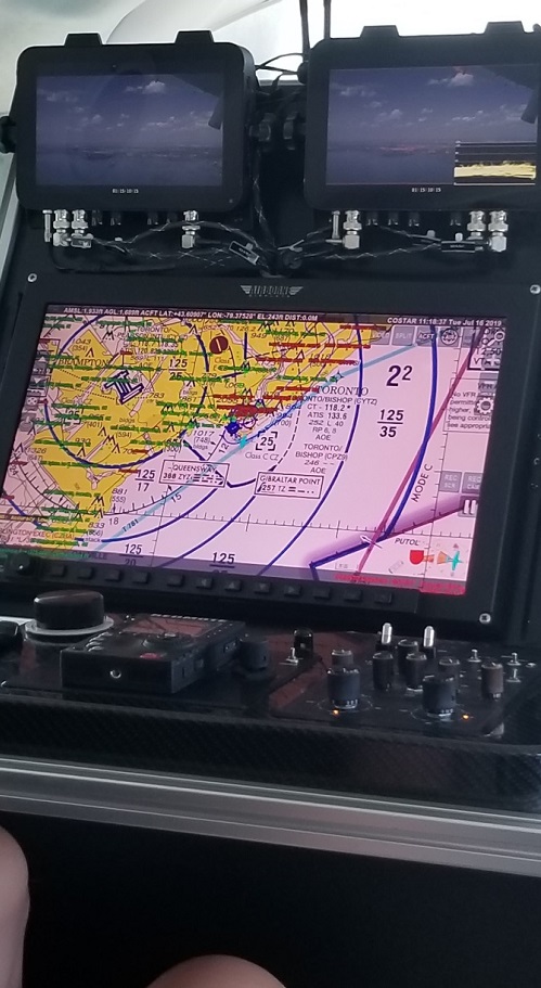
Affixing a camera below the small plane, CoStar flies twice daily—each trip either lasts three hours or concludes when its 512-GB camera is full—to update analytics on how myriad commercial assets are progressing through their development stages.
Although CoStar used to deploy researchers on the ground, the process was painstakingly slow, but flying overtop a city allows it to cover vastly more ground and, on average, shoot about 120 daily stills. At the end of the day, the pictures are uploaded onto an internal server and CoStar’s researchers then fill in the blanks, ascertaining each development’s final tenancy numbers, completion dates, etc.
“We have over 200,000 assets tracked in Canada with multiple data points,” said Mark Ibbotson, CoStar’s managing director in Canada.
CoStar Group, founded in the United States over three decades ago, has grown into a multinational company with several Canadian branches, including in Toronto, Vancouver, Calgary, Edmonton, Ottawa and, soon, Montreal. As a real time analytics and forecasting firm, the company answers questions its pertinent clients may have, whether they’re brokerages, landlords, investors, even tenants and vendors.
“We also integrate third-party feeds, so we have access to demographics—questions to do with average age in an area or median income,” added Ibbotson.
In doing so, CoStar helps its clientele determine potential projects’ viabilities. Lenders, too, use that information to mitigate risks associated with financing projects.
According to Amber Surrency, an aerial research photographer for CoStar, which took CREW on a tour of downtown Toronto yesterday, the crew’s primary focus is to find new developments. Surrency uses a joystick to control the plane’s camera and accordingly directs the pilots.
“The earliest we start documenting developments is when ground is being broken and the foundation is laid,” she said. “It turns the project from ‘proposed’ to ‘under construction.’ It takes two weeks for our researchers to go through all the properties and put them onto the website for developers, brokers, property managers, and more, to see.
“The greatest benefit is that we’re getting real time information into the product faster. We found 30 more points during the last trip, for example.”
Indeed, CoStar has about 12,000 daily analytics updates.
The planes—which fly every day, except during inclement weather, holidays and maintenance days—have become a game changer for the multinational firm, added Surrency.
“We can find 50% more entries just from flying over.”


Neil Sharma is the Editor-In-Chief of Canadian Real Estate Wealth and Real Estate Professional. As a journalist, he has covered Canada’s housing market for the Toronto Star, Toronto Sun, National Post, and other publications, specializing in everything from market trends to mortgage and investment advice. He can be reached at neil@crewmedia.ca.


